Four Day Trek to Wagagai Peak and Return Via the Sasa Trail

Our Four-Day Trek to Masaba and Wagagai Peaks via the Sasa Trail is a truly amazing trekking experience, the different vegetation zones including the newly discovered Heather Zone at the upper levels of the Mukoola Ridge, incredible views and scenery & fantastic professional guides.
Cost $420 inclusive of guides, porters, accomodation, and meals plus the park entrance fee paid directly to Uganda Wildlife Authority UWA of $105 for the four day trek TOTAL $525
Meals are quality with a hearty continental breakfast, lunch bread rolls with sliced ham or chicken, tomato, onion and cheeze with tea or coffee and fruit juice & an apple or orange. Evening meal is, fresh soup of the day, main course and desert. Tea or coffee or filter coffee for those who want the real taste and flavour of Mt Elgon Arabica freshly ground filter coffee.
For East Africans or anyone who may desire, you may elect when booking for a more suitable breakfast of katogo (matoke and meat with tomato & onion) Lunch, bread-rolls with sliced ham or chicken with cheese, tomato and onion, tea or coffee and fruit juice. Evening meal of soup, followed by matoke, boiled rice or posho with stewed goats meat or beef plus desert.
Note it is difficult to prepare mixed European and East African meals for different people on a trek, so must be either one or the other for all and must be advised at least two days before any trek starts so we can purchase the necessary items.
Please Note
In accordance with the International Climbing and Mountaineering Federation (UIAA) recommendations on altitude gain and the risk of high altitude sickness and severe headaches and nausea we do not recommend three day treks to Wagagai Peak at 4,321 metres above sea level. Some operators do sell three day treks however many people experience high altitude sickness and some become very ill and weak. The altitude in Mbale, Budadiri or Sironko is around 1,156 metres. A three day trek would means you would have to skip the first camp which would be an altitude gain of around 2,400 metres (2.4km height gain), three times the internationally recognized limit for altitude gain in one day. Altitude does not recognize fitness, it is your body that needs time to adjust to altitude, less atmospheric pressure and less oxygen. If you rush and do not acclimatise correctly then it may have consequences of altitude sickness, with severe headaches, difficult breathing, nausea and even death. It is also tough for porters to climb directly to higher camps with food and luggages in one day and puts their lives and wellbeing at risk. We recommend a minimum of a four day trek as it would be irresponsible for us to recommend a three day trek to Wagagai Peak. The choice is yours, go slower and enjoy or take the risk.
Itinerary for Four Day Trek to Wagagai Peak and Return via the Sasa Trail
Our Four-Day Trek to Masaba and Wagagai Peaks via the Sasa Trail is a truly amazing trekking experience, the different vegetation zones including the newly discovered Heather Zone at the upper levels of the Mukoola Ridge, incredible views and scenery with fantastic professional guides.
Day 1 is a 7.1km walk with an altitude gain from Elgon Trekkers Base Camp above Bugiboni at 1,720m to Hunwick’s Camp at 2,882m giving an altitude gain of 1,162 metres
The trek starts at Elgon Trekkers Base Camp with a steady climb through coffee plantations, maize, potatoes and onions to Kigoma Primary School.
From here it is a steady walk up to the park boundary directly below the 61m Nabunyifu Falls (meaning cold wind) flanked by sheer cliffs. We have constructed switchbacks in the trail to make it a easier and offer excellent views of the community below and distant mountains. This section is a completely new trail which has never been accessible to tourists before and a great addition to the Elgon National Park. The trail climbs steadily up the Dirigana Valley through the montane forest with huge Podacarpus trees and thick vegetation to where you cross the river and stop for lunch at a shelter. From here it is a steady climb up to the Mukoola Ridge and the Hunwick’s Camp at 2,882 metres where you get fantastic views across the hills and valleys to Masaba Summit.
Day 2 is a steady walk through the montane forest with open areas of bamboo which is now regenerating after heavy exploitation from the community for bamboo shoots, building materials and stakes for crops. Masaba Camp at 3,745m is on a high spot with spectular views far and wide.
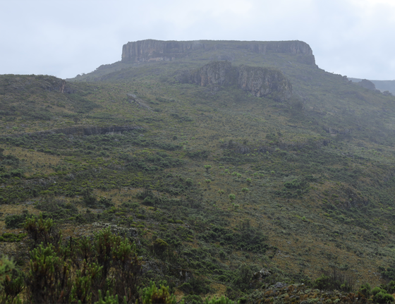
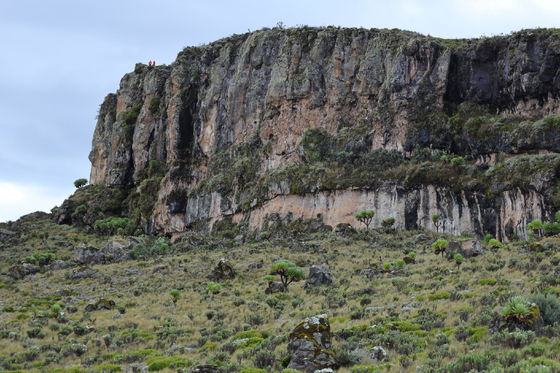
Day 3 From Masaba Camp you have a steady climb up to the top of Masaba Table which is a large rock 700m by 200m standing 80 metres above the surrounding land and which you walk the full length where you climb down and from here the trail passes close to the base of Masaba Summit 4,152m where you have the option to climb the summit before continuing along the rim of the caldera to Wagagai Peak at 4,321m After a short rest at Wagagai you descend to Sasa River Camp via Mude Camp 3,472m for the night or, you may wish to stay in Mude Camp and walk down the next day. This gives you the chance to visit Dirigana Falls as you descend.
Day 4 you descend down through the forest to Base Camp via the waterfalls to finish your trek. Most people reach Base Camp by 12 noon or 3pm if the sleep in Mude Camp.
Gallery
Itinerary
Day 1
Trek starts at Elgon Trekkers Base Camp and crosses through coffee plantationsDay one is a 7.1km walk with an altitude gain from Elgon Trekkers Base Camp above Bugiboni at 1,720m to Hunwick’s Camp at 2,882m giving an altitude gain of 1,162 metres (if you slept in Mbale City at 1,150m the altitude gain in one day would be 1,732 metres) 4 to 5 hours.
The trek starts at Elgon Trekkers Base Camp and crosses through coffee plantations to the Gasawa steel ladders just above Bugiboni Village with some steep sections above the ladders. It then flattens out to pass through the community where the main source of income is coffee, onions, potatoes and maize.
Or if it is not raining you may save a bit of energy and time to enjoy more of the national park, you may get a boda boda up to 2,070 metres to start your hike. From here it is a steady walk up to the park boundary directly below Dirigana Falls with a height of 61 metres flanked by sheer cliffs. We have constructed switchbacks in the trail to make it a easier to reach the top of the escarpment. This is a completely new trail which has never been accessible to tourists before and a great addition to the Sasa Trail. The trail climbs up along the Dirigana Valley and the base of the cliffs where there is a large rock shelter in case you need shelter when raining to the base of the falls where you stand below the falls to get fantastic photos before continuing to the top of the escarpment where you are treated to awesome views across the valley.
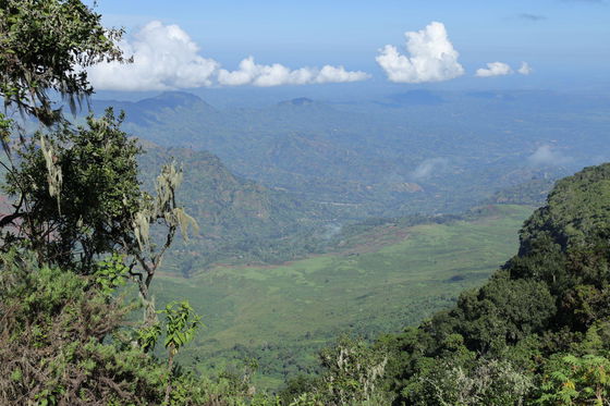
The trail crosses above the falls as you enter the montane forest with huge Podacarpus trees and thick vegetation. You continue up the Dirigana valley before crossing the river and where there is a fantastic rest spot next to the river for a short break and something to eat before a steady climb up to the Mukoola Ridge and Hunwick’s Camp at 2,882 metres. A short climb to the top of the hill from Hunwick’s camp you get fantastic views across the hills and valleys to Mbale City, Sironko and other towns. At night you see the lights of towns far away. It is also the site for our dinning hut from where you may experience excellent views up to Masaba Peak and Masaba Table where our next camp is situated.
Day 2
Masaba CampDay two is a 7.4km steady climb/walk from 2,882 metres to Masaba Camp at 3,745 metres, total height gain of 863 metres taking around 4 to 5 hours easy going all the way.
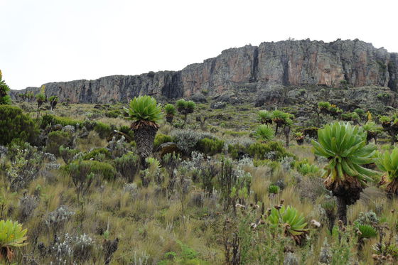
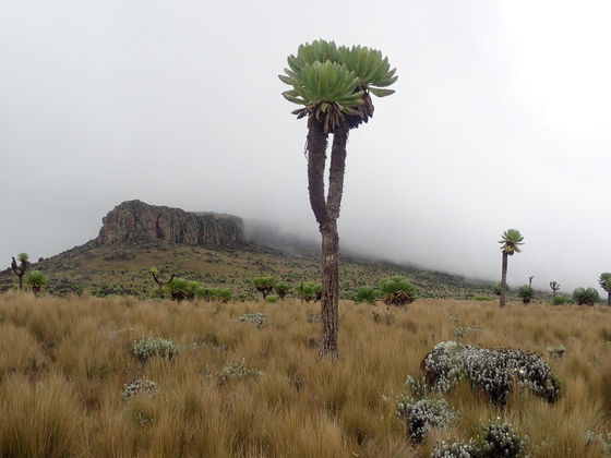
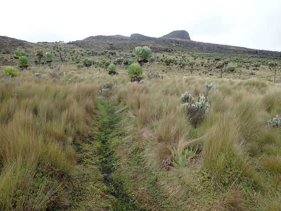
Continue climbing up through the montane forest to 3,200m when you enter open ground. This area used to be the bamboo zone which due to heavy exploitation by the communities for bamboo shoots and building materials is almost none existent but recovering since we opened the trail to tourists. As you continue climbing you will see new bamboo shoots and hope of recovery. Together with Uganda Wildlife Authority we will be implementing a programme to propagate the indigenous bamboo and replant the affected areas so future generations will be able to enjoy the beauty of the bamboo. At around 3,000 metres to 3,300 metres you walk through a newly discovered Giant Heather zone (Erica arborea) after which is breaks into the Heath or Moorland Zone which is open high-altitude grasslands and wildflowers with scattered areas of Giant Heather and rolling hills. We take a short break at a rest point in the upper levels of the Heather Zone before walking the last two kilometres to Masaba Camp @ 3,745 metres. You get excellent views from Masaba Camp across the high altitudes grasslands, the stunning forests and foothills. At night you see the lights of Mbale City in the distance.
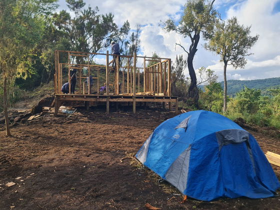
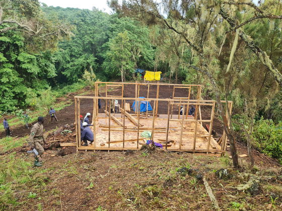
At present the facilities are basic and accomodation is camping however we will soon be constructing huts and other accomodation.
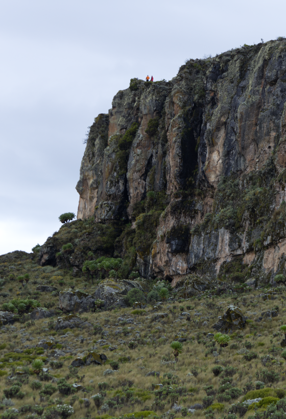
After lunch you may decide to climb 1.2km climb to the top of the Masaba Table which is flat rock with vertical cliffs all around averaging 70 to 90 metres above the surrounding moorland grasses studded with the giant lobelia and groundsel plants. Masaba Table is one huge rock 700 metres long and 200 metres wide and an average height above sea level of 4,000 metres and offers exceptional views.
Day 3
Wagagai PeakDay three is a 6.4km walk with an altitude gain or 576 metres up to Wagagai Peak at 4,321 metres then descend back to Mudi Camp or you may decide to descend to Sasa River so as to reach the base camp around 11am the following day. However the trail to Sasa River Camp from Mude Camp 7.2km is in good condition and easily accomplished in around over two hours and from Sasa River Camp to Base camp is about 3 to 4 hours walk so you may opt to sleep in Mude Camp to enjoy the high altitude environment and maybe catch the sight of a Several cat or mountain hares at night.
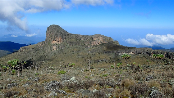
As our trail passes close to the cliffs surrounding Masaba Table and just below Masaba Peak (Jackson’s Summit) you have the option of a 30 minute climb to summit Masaba Peak and enjoy excellent views across the caldera to the peaks in Kenya. Is best to start your journey from Masaba Camp by 6.30am or latest 7am to trek the 2.6km and be on top of Masaba Peak before the mountain fog closes in.
Day 4
Descend down through the forest along the original Sasa TrailDescend down through the forest along the original Sasa Trail before turning and cutting across to the top of Dirigana Falls through and area of Giant Tree Ferns and down to Elgon Trekkers Base Camp at Bugiboni.
Rates
$380 trekking fees per person plus $105 park fees paid directly to Uganda Wildlife Authority at Budadiri or online.
TOTAL $485 all inclusive of park fees, accommodation whilst on the trek, meals, guides and porters.
Share This Page